Drones with Infrared Particle Tracking System used to Measure Flow in Rivers
Drones provide an “eye in the sky” which can be very useful for water scientists. Many water bodies are often surrounded by difficult terrain, making it difficult to observe changes over time. Extreme droughts like the ones currently in California and Texas make the use of drones for monitoring rivers and lakes especially important.
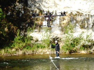
A multinational team of American, German, and Estonian researchers have teamed up to measure the flows in rivers with unmanned aerial vehicles (UAVs) using a new real-time particle tracking technology.
Obtaining the speed of the water in a river traditionally involves engineers wading into the river or using boats outfitted with special equipment for flow measurements.
American river scientist Dr. Jeffrey Tuhtan has worked in Swiss, Austrian, and German rivers where the steep alpine terrain often makes direct flow measurements dangerous or even impossible.
“There is a growing need to measure river flows on-demand, especially considering rapid changes in weather patterns and growing personnel costs associated with this kind of surveying work. UAVs provide us with an opportunity to access hard-to-reach sites, and can also deliver more accurate survey information at much lower costs. It’s a real win-win for the engineering community.”
Using conventional civilian UAVs equipped with the new IR-LOCK sensor technology has allowed the research group to add a new tracking technology to their list of capabilities. Thomas Stone integrates the IR-LOCK sensors into various UAV project.
“At IR-LOCK, we are primarily focused on providing precision landing capabilities for multi-copters, which is useful for automated charging and navigation in difficult environments. But this recent flow measuring project is an excellent demonstration of the need for precise remote sensing in non-traditional applications. The usefulness of UAVs is only limited by our imagination and creativity.”
The team consists of IR-LOCK, the American developer of the UAV-based tracking technology, HyDroneS, a German consortium specialized in river mapping and engineering, and the Estonian Centre for Biorobotics (CfB) at the Tallinn University of Technology, which provides specialist know-how in high-resolution particle-based flow measurement.
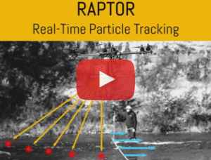
Using a special camera system mounted on the drone, floating particles outfitted with infrared LEDs are located and tracked in real-time. CfB is developing special computer software which is capable of determining the motion of each particle and calculates a map of the river’s flow speed.
When the speed of the river is known, engineers can use this information to improve their computer models which are used to predict water levels for both flood and drought conditions.
The approach can also be used internationally in locations where no survey data has been collected. Such data could be critical for decision makers planning to build new water infrastructure in developing countries such hydropower plants and water storage reservoirs.
A video of this innovative new approach, called RAPTOR – Real-Time Particle Tracking shows how the IR-LOCK technology can be used with floating IR targets on the water surface. RAPTOR is currently undergoing testing at the laboratory scale, but HyDroneS, CfB and IR-LOCK are planning to test the technology in a river near you soon.


